|
South end of tunnel. |
South end of tunnel. |
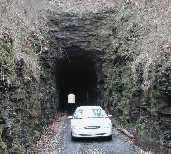
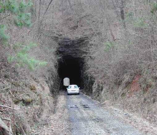
North end of tunnel. |
North end of tunel |
|
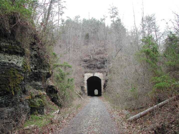
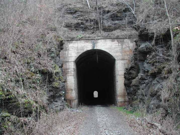
South end of tunnel. |
South end of tunnel. |
North end of tunnel. |
North end of tunel |
|
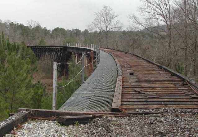
5 Mile creek trestle. |
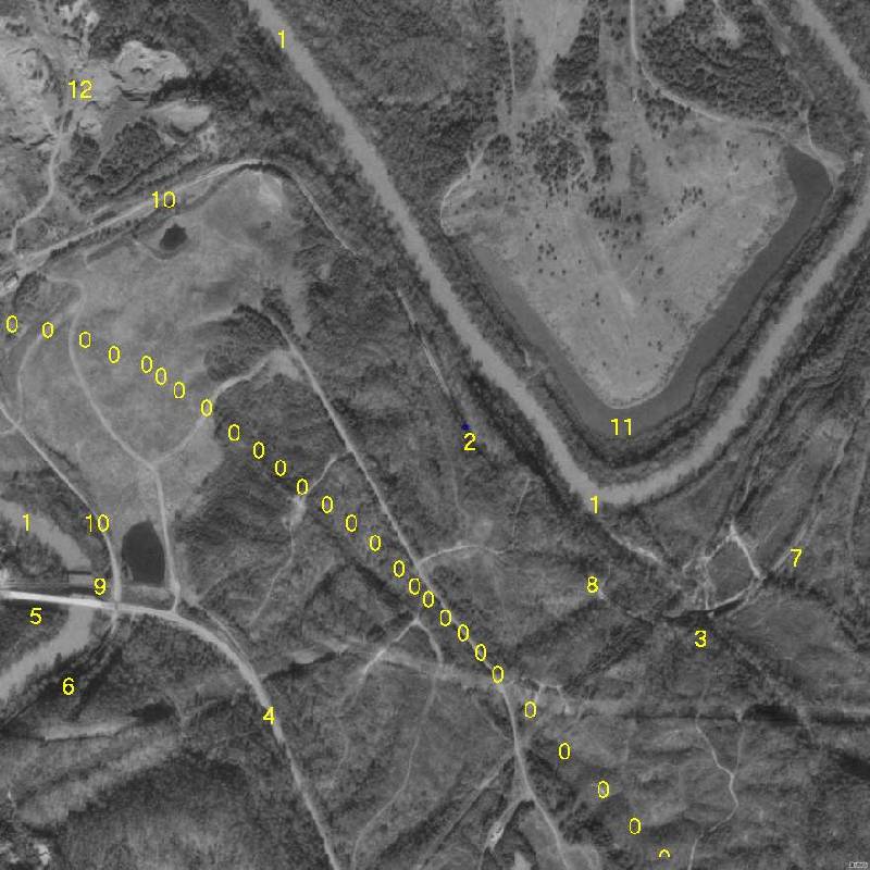
Aerial Photo |
This area has been known as Flattop as long as I can remember. I used to ask my dad if it was flat. He would answer yes, why do you think they call it Flattop. The area shown in the aerial picture is approximately one square mile. If you are a outdoorsman, rail fan, history buff, or hiker this is a dream come true. The aerial photo contains the Locust Fork branch of the Warrior River, north and south ends of an abandoned train tunnel, trestle over 5 mile creek, new bridge on Flat Top road, old bridge no longer in use on Flat Top road, trestle adjacent to the river, 5 mile creek, the old CSX abandoned rail line, a red rock quarry, and a boomerang shaped lake. The lake is number 11 in the aerial photo and I'm not sure about the origin of it. If anyone has info on it please share it. This aerial photo was taken before Corridor X construction was started. The approximate location of Corridor X is shown in the aerial photo. For GPS users the following coordinates are near the North end of the tunnel. 33° 39.740 87° 00.801. At the time of this writing (march 2005) you can actually drive to and thru the tunnel. If you have the time this area is well worth a visit.
Legend for Aerial photo objects.
0. Corridor X, this is the approximate location.
1. Locust Fork branch of the Warrior River.
2. North end of the tunnel.
3. Trestle over 5 mile creek.
4. Flat Top Road.
5. New bridge on Flat Top Road.
6. Trestle adjacent to the river.
7. 5 mile creek.
8. South end of the tunnel.
9. Old Flat Top road bridge.
10. Old rail bed. Abandoned CSX line.
11. Boomerang shaped lake.
12. Red rock quarry.